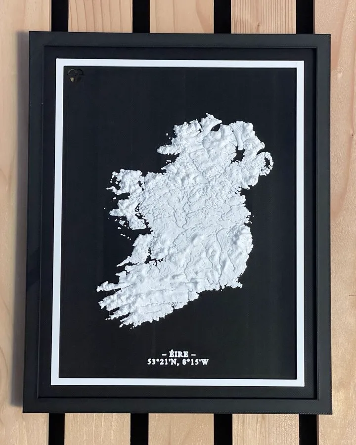
3D printed topographic map of the island of Ireland in white on a black background, framed

Irish Collection · Handcrafted in Dublin

Ireland 3D Map

53°21'N  8°15'W

€29.00

The whole island, from the Donegal coast to the Kerry peninsulas, as a single object. Mountains, bays and the shape of the Atlantic coast captured in 3D relief from real elevation data, in white on black, with the coordinates engraved on the piece.

Secure checkout via Stripe · Shipping & returns

Why a map of the whole island?

Some gifts are for a place you visited. This one is for the whole country. Ireland as one shape, with the Atlantic coast cut into peninsulas and bays on the west, and the mountains of Kerry, Connemara, Wicklow, Donegal and the Mournes standing up out of the flat middle.

This map is built from real geographic and elevation data. The terrain is modelled in 3D, then printed layer by layer in our Dublin workshop in eco-friendly PLA. The island is white against a black background, and the coordinates are engraved at the base of the piece.

It is a good present for someone who has moved away and misses home, for anyone who has moved here and made it theirs, or for yourself. It looks as good from the front as it does from the side, because the light catches the relief.

Every map is printed fresh when you order it. No stock, no warehouse, no two prints exactly alike. Want a different place instead? We also make a custom 3D map of any city, street or place in the world.

Want a map of your own place?

Design a 3D map of anywhere in the world, from the street where you met to the town you grew up in, and see it in 3D before you order. From €49.50.

Design your map